GNSS-Independent Visual Navigation
Reliable Positioning with Visual Navigation
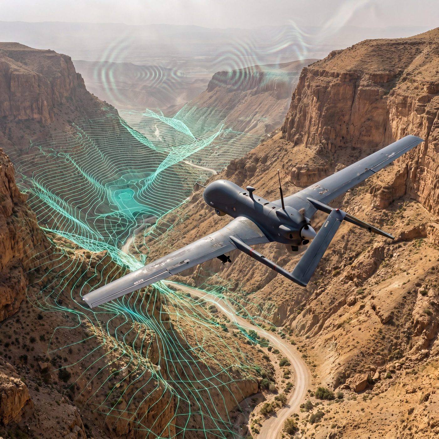
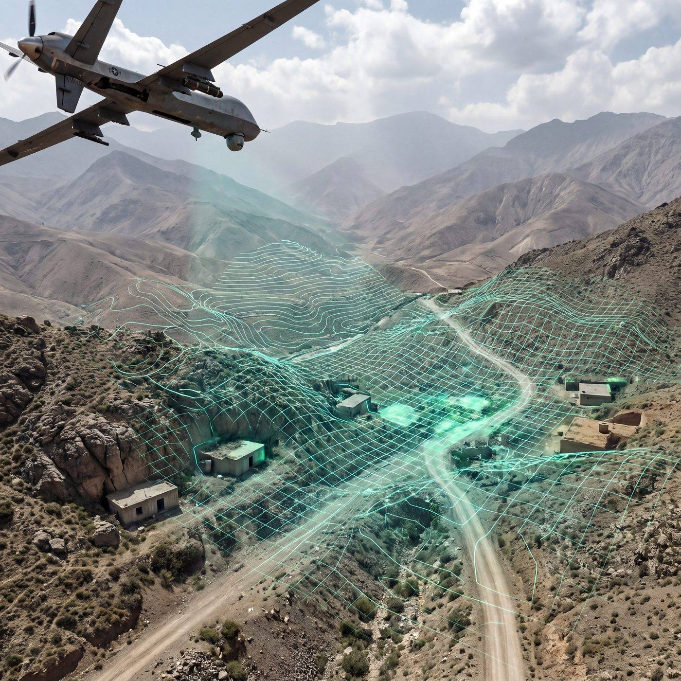
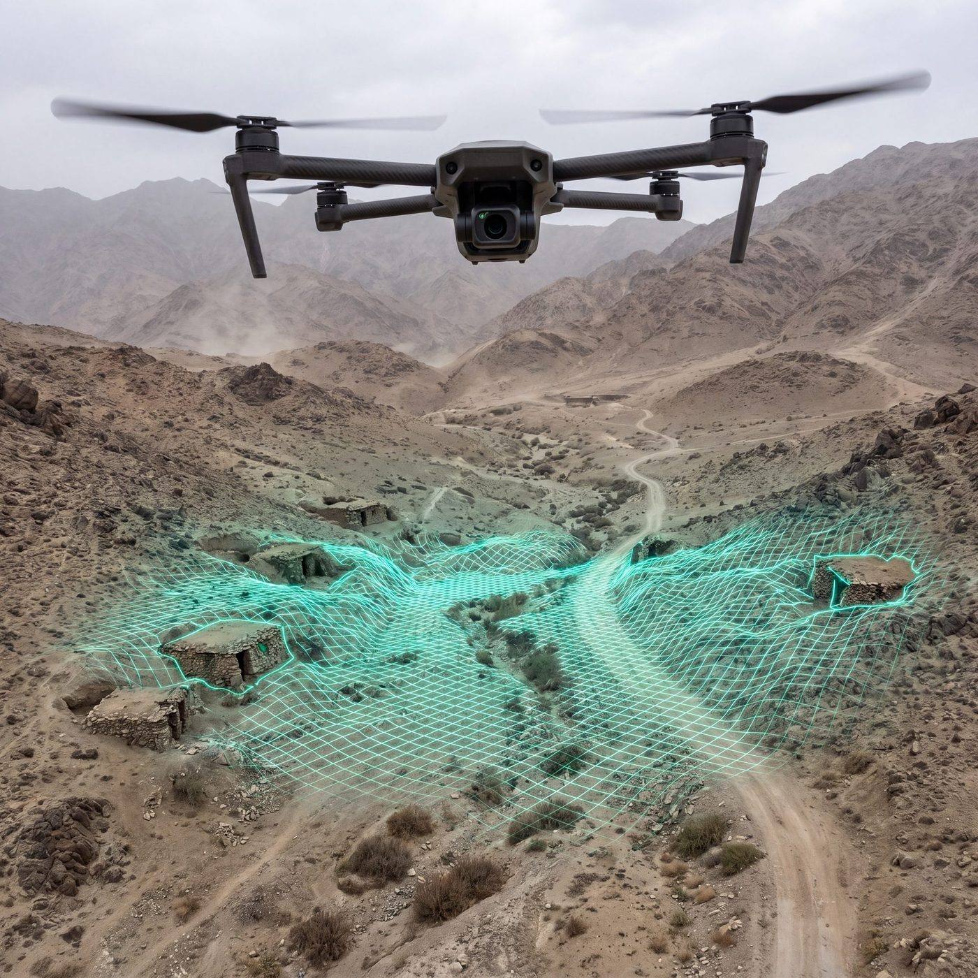
VANAV derives position, velocity and orientation from onboard camera imagery, supporting mission continuity in jamming and spoofing environments.
Explore field evidence
10 Hz
10 Hz (instantaneous output)
25 Hz
25 Hz (platform/conditions dependent)
50-900 m
50-900 m
~40 W
~40 W
Operational Logic
A positioning line independent of external signals
VANAV runs visual odometry, visual localization and PnP-based methods on-edge, providing alternative position information to the flight computer when GNSS signals weaken or are manipulated.
Passive navigation in GNSS-denied environments
AI-powered visual localization
Architecture resistant to jamming/spoofing
Low-latency real-time processing
Return-to-Home (RTH) and route continuity
Lightweight, compact, low power
Visual Positioning
Terrain imagery becomes navigation data.
Camera streams generate meaningful position output for the flight computer through terrain matching, visual odometry and confidence scoring.

Technical Values
Technical Specs
Data Output Rate
10 Hz (instantaneous output)
Image Processing
25 Hz (platform/conditions dependent)
Operating Temperature
-20 °C ~ +55 °C
Operating Altitude Range
50-900 m
Power (Field)
15-45 W
Generated Data
Position, velocity, orientation, acceleration, confidence score
* Typical values from PDF; field ranges provided in the technical table.

Architecture Flow
VANAV is a modular system integrated with the flight computer, combining visual odometry, visual localization, and PnP-based methods. It runs on-edge without external connectivity.
- Independent module integration
- Bi-directional communication with mission computer
- Activation without interfering with manual control
- Operation in jammer/spoofing environments
Field Tests
Field Tests - Summary
Kalecik/TR - 12.11.2022: Initial flight tests.
HAVELSAN - Karaağlı - 01.03.2023, 04.07.2023 (noon), 12.07.2023 (evening): Multiple mission profiles.
Figures compiled from field summaries.
Test-1 (Mar’23)
500 m, 30 min, 837 images → 811 coordinates | Accuracy: ~20 m (2D), ~37 m (3D)
Test-2 (Jul’23/Noon)
500 m, 900 images → 751 coordinates | Accuracy: ~24 m (2D), ~41 m (3D)
Test-3 (Jul’23/Evening)
500 m, 2000 images → 1751 coordinates | Accuracy: ~22 m (2D), ~36 m (3D)
Category
Visual Navigation, Computer Vision, Artificial Intelligence
Scope
Passive position, velocity, and orientation in GNSS jamming/spoofing environments
Platform
Fixed/rotary-wing UAVs and various drone types
Operating System
Linux (Ubuntu)
Processing Unit
NVIDIA Jetson AGX Orin Industrial 64 GB
Outputs
Position (2D/3D), velocity, acceleration, orientation, confidence score
Accuracy (Typical)
2D ~7 m @ 1500 ft; 3D ~10 m @ 1500 ft
Power Consumption (Typical)
~40 W